

New Rochelle dentist and pilot, Dr. Robert Perler takes off at Westchester County Airport with co-pilot Jack Hessel and his father, John Hessel, who were on their way to circling over New Rochelle at 1,000 feet to take aerial photos of New Rochelle as part of the 10-10-10 New Rochelle Project. All day long dozens of photographers will be taking thousands of photos as part of an effort to document through photos a day in the life of New Rochelle.

Mapping out the flight plan.

Heading out to the plane

Checking the camera’s custom anti-glare fitting.

Checking the camera’s custom anti-glare fitting.

The crew: Pilot Dr. Robert Perler, photographer John Hessel and co-pilot Jack Hessel.

Co-pilot Jack Hessel mans his station.

John Hessel tests camera angles inside the Piper Saratoga II HP.

Pilot Dr. Robert Perler taxis out onto the runway.
Great Project Kudos to Ms. Hessel
What a great project and great pictures. This is a great site and to those who say it’s negative I say watch the report from Finance Commissioner Howard Rattner at the latest council meeting, that is negative and depressing.
Great Photos!
Thanks Bob. We were down here on the ground in the library parking lot taking pictures up. The plane was really moving, 120 mph. On some shots I only caught the tail!
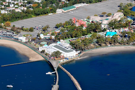
Two of the Aerial Photos
John Hessel submitted these photos!
Here is Rye Playland:
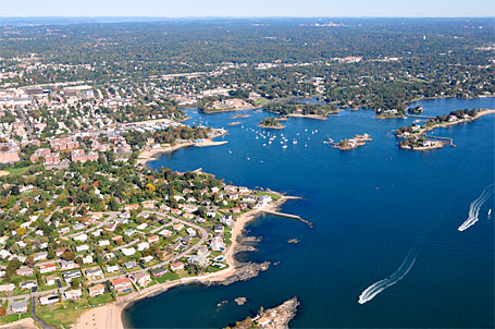
Here is one of New Rochelle!